| Click on the name of the island for further information | |
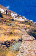 | ALICUDI It is the westernmost island of the archipelago. The ancient name Ericusa is due to the rich vegetation of heather, of which the island is covered. The heather is part of the history and life of the islanders, who have always used it to cover huts and, with the root, pipe stoves. Alicudi is a rounded cone that culminates with the Filo dell’Arpa relief and has an area of 5.2 sq km. The inhabitants, called alicudari, are about 140 and live in the only inhabited center (Alicudi porto), fishing and little agriculture. Of volcanic origin, the island is largely made up of the extinct volcano of Montagnola born about 150,000 years ago following effusive and explosive eruptions |
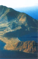 | FILICUDI Formerly called Phoenicusa (rich in ferns), together with Alicudi it is geologically the oldest of the Aeolian Islands. It has an area of 9.5 sq km and its highest point, the Fossa delle Felci, is at 773 meters. The inhabitants, called filicudari, are about 250, scattered in the three main inhabited centers: Filicudi porto, Pecorini a mare and Valle Chiesa. The conformation of the island is slightly oval and extends to the south-east in the promontory of Capo Graziano which is a small peninsula connected to the main part of Filicudi by a strip of land. The island is made up of the products of six volcanic centers. The oldest must have been located in the sea near the coast of Fili di Sciacca. |
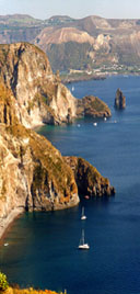 | LIPARI It is the largest island of the Aeolian archipelago. It has an area of 37.6 square kilometers and is 24 nautical miles from the Sicilian coast. Its inhabitants, called Liparesi or Liparoti, are about 9000 and populate the hamlets of the island: Canneto, Acquacalda, Quattropani and Pianoconte. With the exception of Salina, all the other islands are administratively dependent on Lipari. Like all the Aeolian archipelago, Lipari has volcanic origin. The oldest part of the island is the western one where, between 160,000 and 134,000 years ago, 12 volcanic layers are identified, including the Timponi. This phase of intense eruptions was followed by a long pause in volcanic activity. In the second period, about 100 thousand years ago, the volcano of Monte S. Angelo was created. The volcanoes of the third period (40,000 and 8,000 years ago) erupted pumice, forming a series of domes, including Monte Guardia and Monte Giardina. After a long pause, the eruptive activity resumed in the north-eastern part with the launch of enormous quantities of pumice, which made up Monte Pelato, and with the emission of the obsidian flow of the Rocche Rosse (VII) century AD. C. Even in historical times there were eruptions of pumice which covered with a layer of very fine dust the most ancient archaeological levels in the Diana district and in the acropolis of the Castle. |
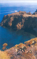 | PANAREA Panarea, formerly called Hycesia, is the smallest island of the Aeolian archipelago. It has an area of only 3.4 square kilometers and is 11.5 miles from Lipari. Its 280 inhabitants, called panarioti, live in three districts: Ditella, S. Pietro and Drauto. Panarea is framed by the nearby islets of Basiluzzo, Dattilo, Bottaro, Spinazzola and the rocks of Lisca Bianca, Lisca Nera, Panarelli and Formiche. Scholars believe that Panarea and the rocks and islets that surround it are the remains of an ancient underwater volcano partially submerged by the waters in the interglacial periods. In the currently emerged part it is possible to recognize a single volcano on whose flanks numerous secondary eruptive centers have been implanted. |
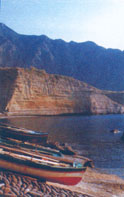 | SALINA After Lipari, it is the second largest island of the archipelago: about 27 square kilometers in area. It is the highest of the 7 islands with the mountains “Fossa delle Felci” and “Monte dei Porri” also long-extinct volcanoes. From the presence of these two peaks its ancient name Didyme, which means Gemini, dates back. The current name derives from the presence of a small lake from which salt was extracted which was then used for the conservation of capers and fish. It is the second most populated island of the archipelago with about 2,300 inhabitants. It is divided into three autonomous municipalities: S. Marina, Malfa and Leni. The hamlets are called: Lingua, Rinella, Val Di Chiesa, Pollara and Torricella. In the territory of Salina there are traces of six volcanoes. |
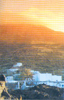 | STROMBOLI The farthest and most easterly of the Aeolian islands, Stromboli is about 22 miles from Lipari. The ancients called it Strongyle, the rotunda. It has an area of 12.6Kmq. with about 420 inhabitants, called Strombolani. Its active volcano is about 920 meters high above the sea and the seabed is very deep (1200 m.). The island is a volcano that emerges from the sea. The emerged part, in persistent activity for at least 2000 years, was formed mainly during two cycles of activity. An ancient cycle, consisting of eruptions of solid material and lava flows, which formed the entire eastern part of the island, and a more recent cycle, consisting mainly of lava flows, which formed the entire western half of the island. |
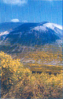 | VULCANO The ancient Hiera (sacred), according to the Greeks home of the God of Fire Hephaestus, is the southernmost island of the Aeolian archipelago and is the closest to Sicily. It is separated from nearby Lipari by a canal about 1.6 km wide. Its surface is 21 sq km. From a geological point of view, the island is made up of 4 volcanoes: Lentia, Vulcano Piano, Fossa di Vulcano and Vulcanello. The only one to be considered still active is the Vulcano della Fossa. The volcanic activity of this island was known since ancient times to the Greeks and Romans, who were strongly impressed by it. |

